1st Grade Geography Lesson with Google Earth
Lesson Objective
Students will be able to compare the size of different geographical locations (ex. continent, country, state/province, city, etc.) with a 3D mapping tool (Google Earth).
Content Standards of Lesson (California)
1.2 Students compare and contrast the absolute and relative locations of places and people and describe the physical and/or human characteristics of places.
- Compare the information that can be derived from a three-dimensional model to the information that can be derived from a picture of the same location.
Learning Activities
1. As a class, we started a K-W-L chart (what they know, what they want to know).
2. I presented my Geographical Location Presentation while students filled out their graphic organizer. The presentation helped explain the different location categories, and presented the challenge: Find where Mr. Lee lives!
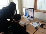
3. Students opened Google Earth and searched for specific locations in order to find my home (continent, country, state, city, and street). Google Earth's zooming feature demonstrated the scale of these locations compared to one another.
4. Students also found their school and home.
5. We completed the K-W-L chart (what they learned) and reviewed the learning objective.


Comments
Post a Comment